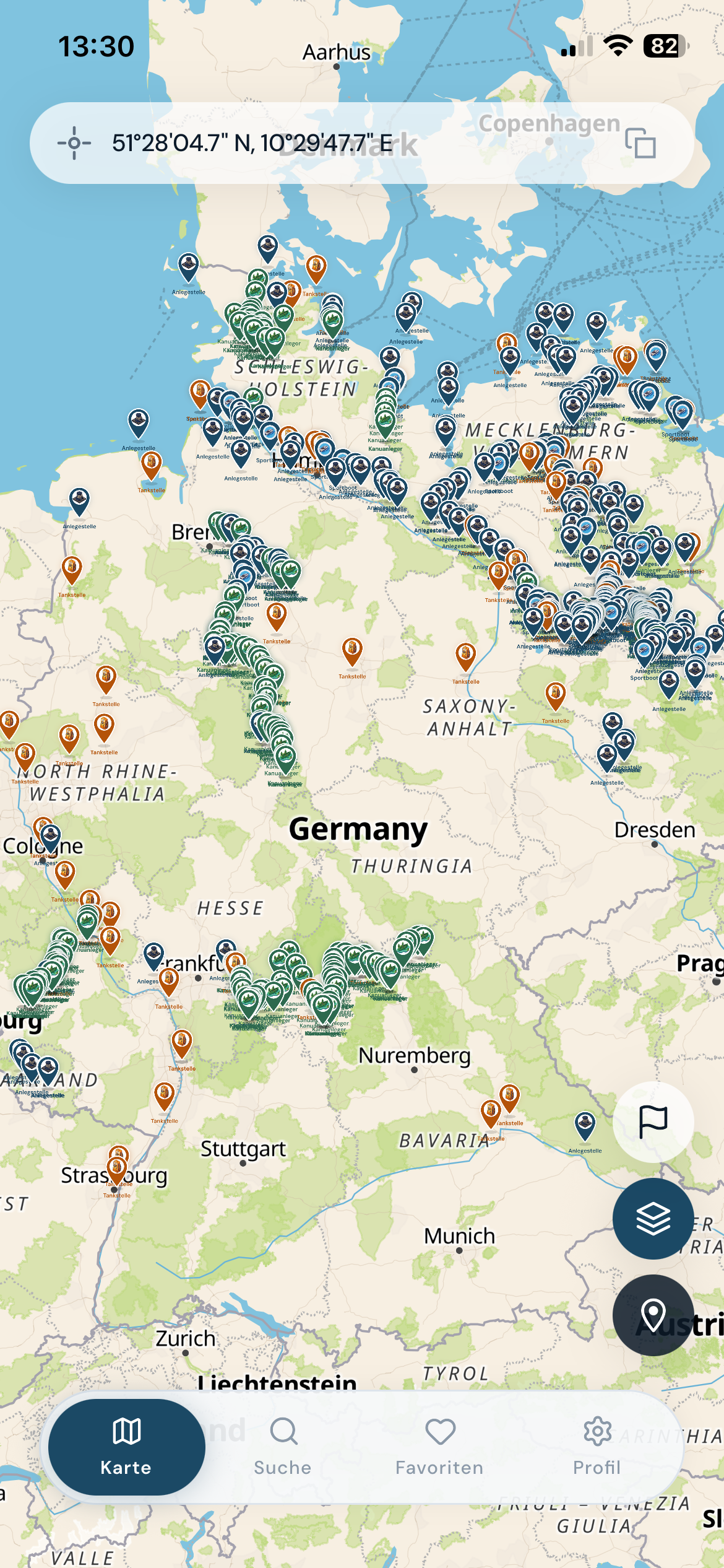
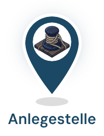
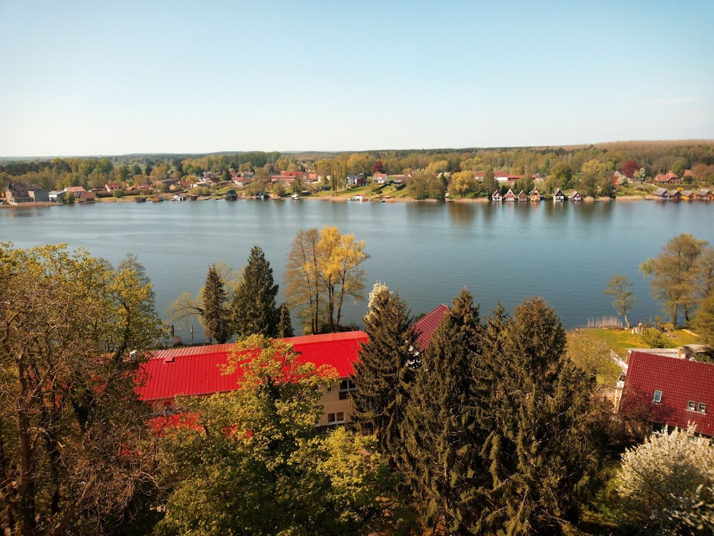
Mooring stations across Germany. Offline. With the Gelbe-Welle mark.
Dalbi shows 543 moorings carrying the Gelbe-Welle quality mark, 139 boat fuel stations, 420 additional researched moorings, the federal WSV waterway network, and 99 official WSV signs and sound signals in one app that works without signal. Built for inland water tourists, recreational boaters, and paddlers in Germany.
1,102 mooringsOffline · Saarland to RügenGelbe-Welle stations · No account
Since 2004 · German Tourism Association
What is the Gelbe Welle?
The Gelbe Welle (Yellow Wave) is the German Tourism Association's quality mark for water-side moorings on Germany's inland waterways. Since 2004, it has been awarded to marinas, city moorings, and canoe rests that meet a fixed set of standards: reachable by boat, maintained, with clearly stated opening hours and supplies.
Until now there has been no digital, searchable overview of the stations carrying the Gelbe-Welle mark. Dalbi shows them on a map with filters, distance, address, and, where available, photo.
On the map, the 543 certified stations carry a gold pin — recognisable at a glance among the additional researched moorings.
Location data comes from OpenStreetMap, the waterway network from the WSV. On-site photos, where available, from our own captures, operator submissions, and Wikimedia Commons. Dalbi does not source data from the German Tourism Association; the Gelbe-Welle mark only identifies which moorings we display.
Three screens
Search, save, moor.
Find stations, save them for the next trip, and at the dock read distance, address, and photo at a glance. Three screens, three jobs.
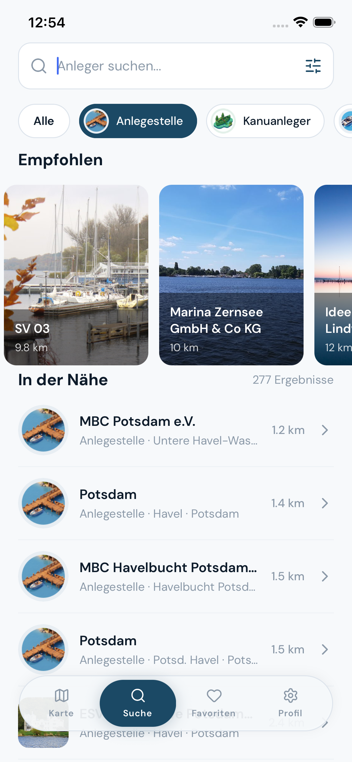
Search by mooring, canoe access, fuel station
Full-text search across all 1,102 stations. Filters by station type and quality mark, a row of recommended nearby moorings, and a list sorted by distance.
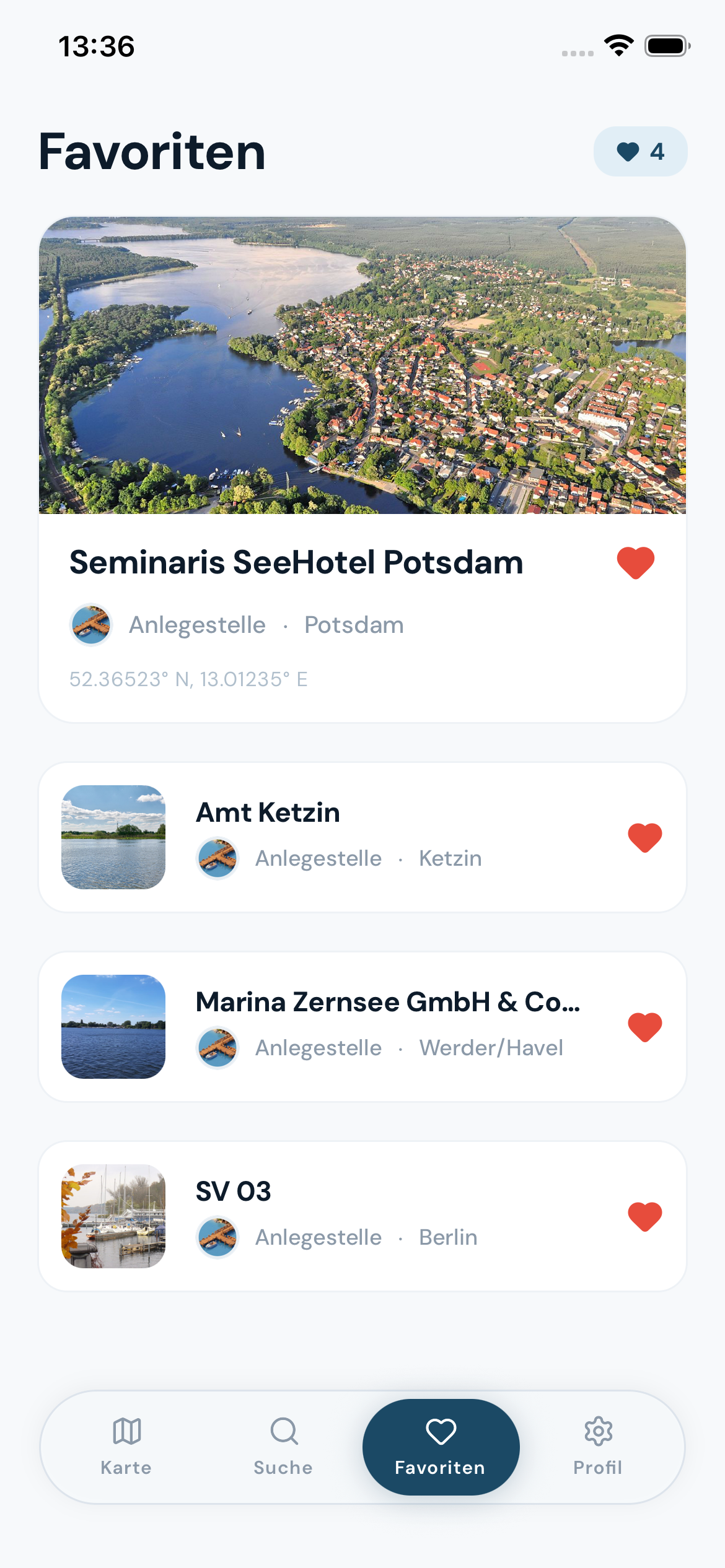
Favourites as your personal logbook
Save preferred moorings on your device with photo preview and distance. No account, no syncing, nothing handed to third parties.
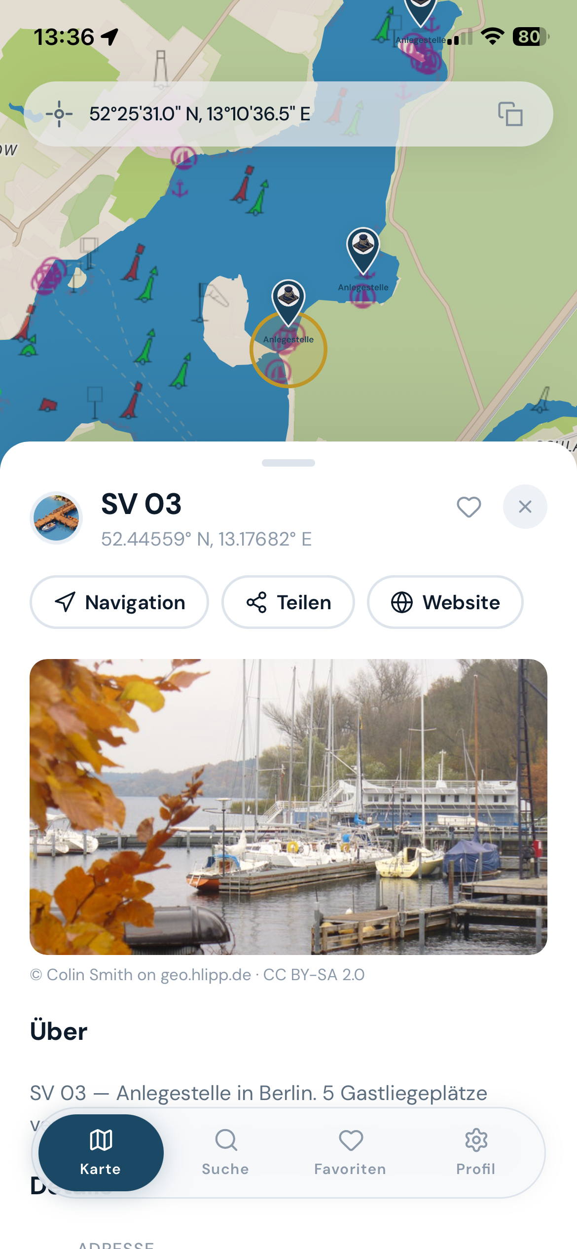
Station detail with photo, contact, and amenities
Detail pane with distance, address, on-site photo, opening hours, and fuel grades (for fuel stations). Where the operator listed them in OpenStreetMap: phone (tap to dial), email (opens your mail app), and an amenity row showing drinking water, shore power, shower, toilets, and sanitary dump.
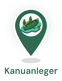
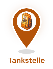
Three station types
Moorings, canoe access, and fuel.
Each of the 1,102 stations in Dalbi belongs to one of three types. The filters in the app follow the same split, the search too.
Mooring
Mooring stations
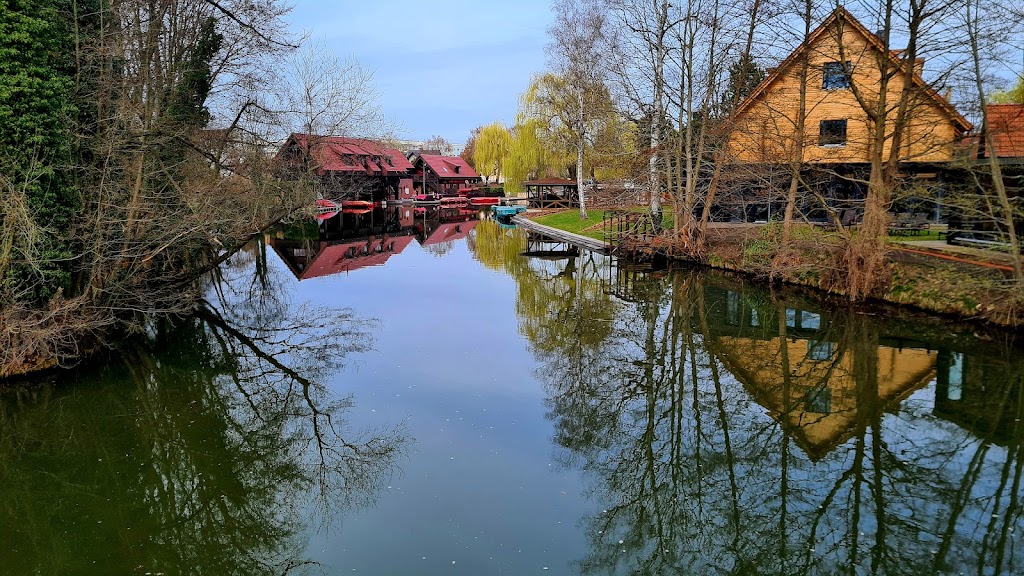
Piers, jetties, and bollards on Main, Weser, Mosel, Spree, Havel, and Elbe. Classic city moorings, scheduled-boat docks, overnight charter berths, and marinas with finger jetties, shore power, and a harbour master. Over 500 entries — the largest of the three types.
Canoe
Canoe access
Low wooden jetties, sand beaches, and water-tourer rest stops on German rivers and lakes. For kayak, canoe, and SUP, often with picnic and overnight options.
Fuel
Boat fuel stations
139 boat fuel stations for diesel and petrol right on the water. With opening hours and fuel grades where mapped in OpenStreetMap.
What you can plan with Dalbi
Three trips, one app.
Photo: Michal Osmenda, CC BY-SA 2.0
, via Wikimedia Commons
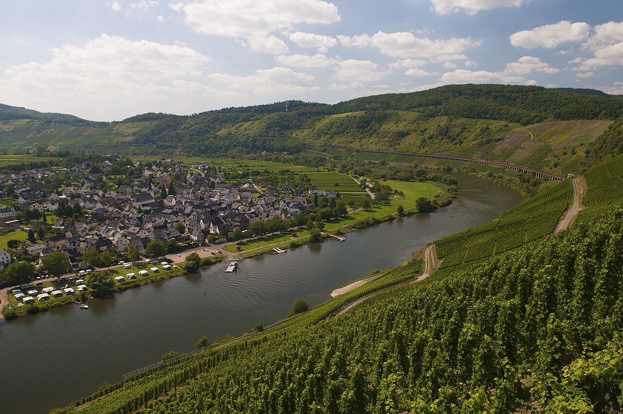
3 days · Houseboat
Mosel weekend.
Trier → Bernkastel-Kues → Koblenz
Classic charter region. Moorings every few kilometres, fuel station in Winningen, Bernkastel-Kues with 35 stations as the centre.
Moorings along the route
Fuel station in Winningen
Photo and address per stop
Photo: Botaurus, public domain
, via Wikimedia Commons
7 days · Charter
Müritz charter.
Waren → Plau → Mirow
Mecklenburg lake plateau: Europe's densest inland charter region. 173 stations across Mecklenburg-Vorpommern around Müritz, Kölpinsee, and Plauer See, with rest stops along the Peene and the Elde-Müritz waterway.
Low wooden jetties, picnic and overnight places. Quiet channels instead of shipping lanes. For kayak, canoe, and SUP, no boat licence required.
Canoe access in the Spreewald
Sand beaches and jetties
Overnight on the Spree
Route hints are illustrative; the skipper verifies legs and distances against official sources (WSV, ELWIS). Photo licence and credits per image.
What the app does
Search, filter, moor.
Dalbi is not a chartplotter and not an ECDIS app. It is a directory with a map, built for boaters who want to know where the next safe stop is and how to get there.
Route planning on waterways and lakes.
Tap a mooring: Dalbi draws the line over the actual water network — federal waterways, rivers, and lakes up to the Müritz —, not over the road, and counts distance and ETA down to 0 m. Where no waterway is recorded, such as along the coast, it draws a straight-line estimate with a notice. Fully offline on the device.
Three symbol families
Mooring, canoe, fuel. Every symbol carries its type in shape, background, and pictogram. Recognised at a glance, no reading required.
Favourites as a logbook
Save stations as favourites. Stored on your device only, no account, no syncing to outside servers. With photo where one exists, and distance from your current position.
Filter by type, waterway, distance
Just fuel stops on the Mosel? Just canoe access in the Spreewald? Three filters, three seconds, a different map.
Offline for all of Germany
Map data, stations, and the waterway network are part of the app itself. No internet round-trip, no waiting. Works on the Müritz just as well as behind the Müggelberge.
Privacy by default
No account, no trackers, no cookie banner. On first launch the app fetches the OpenFreeMap style once; after that it works offline. Sparing with data, because nothing else gets sent to us or to anyone else.
Call, email, see the amenities
Where the operator left a phone number or email in the OpenStreetMap entry, Dalbi dials with one tap or opens your mail app. The amenity row — drinking water, shore power, shower, toilets, sanitary dump — sits as a chip cluster directly under the photo.
Harbour dining at the mooring
Which mooring has a restaurant, a harbour pub, or a snack bar within walking distance? Dalbi shows the dining options nearby right in the station view — and a filter surfaces the moorings with a kitchen close at hand.
99 WSV signs and sound signals
The official German inland-waterway reference (Sichtzeichen and Schallsignale) — prohibition, command, information, and sound signals, sorted into eight categories and searchable. Fully offline, always with you.
Where Dalbi pays off
Stations by federal state.
01
Brandenburg
Spree, Havel, Dahme, the Spreewald. The largest region by station volume in Germany. Charter cruising between Berlin and the Mecklenburg border, plus Spreewald canoe access and the Havel lakes.
208 stations
02
Mecklenburg-Vorpommern
Müritz-Elde waterway, Peene, the Mecklenburg Lake District, and the Baltic coast. Europe's largest inland charter region, centred on the lakes around Plau and Waren.
173 stations
03
Lower Saxony
Weser from Hann. Münden to Bremen, plus Elbe, Aller, and Oste. A classic water-tourer region with closely-spaced moorings along the entire Weser.
126 stations
04
Schleswig-Holstein
Eider, Treene, Ratzeburger See, and the Baltic coast with the Schlei and the Bay of Kiel. Transition region between inland and coastal cruising, with marinas in Kiel and Ratzeburg.
108 stations
05
Berlin
Spree, Havel, Wannsee, Tegeler See, Müggelsee. City moorings in a capital where you can still tie up freely on a summer evening.
93 stations
06
Bavaria
Mostly along the Main, from Schweinfurt through Ochsenfurt and Volkach down to the river mouth. Classic water-tourer territory along the great Main bend, with marinas in Lohr and Haßfurt.
95 stations
The remaining 299 stations are spread across Rhineland-Palatinate (66, mostly Mosel), Saxony-Anhalt (65), North Rhine-Westphalia (56), Hesse (28), Baden-Württemberg (24), Bremen (21), Saxony (12), Thuringia (11), Hamburg (9), and Saarland (7).
Pricing
Start free. Go Pro when you want more.
The map, search, and all 1,102 stations are free — no account, no advertising, no cookies. Dalbi Pro unlocks route planning, full station details, all signs, map layers, and unlimited favourites. Apple or Google handles billing — restore anytime from inside the app.
Free
Dalbi
€0
forever · no account
No purchase needed — download and cast off.
Map with all 1,102 stations, offline
Search, filters, and up to 3 favourites
Sign reference preview (2 of 99)
Subscription7 days free
Pro Annual
€4.99
per year · auto-renewing
Try 7 days free
Early-bird through version 1.1; €6.99 per year afterwards.
Route planning & live navigation over waterways and lakes
Station details: photos, opening hours, services, contact
All 99 visual signs & sound signals
Satellite map and OpenSeaMap layer
Unlimited favourites · cancel anytime in the store
Lifetime
Pro Lifetime
€19.99
one-time · no renewal
Founding price through version 1.1; €24.99 one-time afterwards. Route planning and live navigation included.
Buy once, Pro forever — incl. route planning
All updates included
No renewal, no reminder
Purchases are handled by Apple App Store and Google Play — separate purchases per platform. If you switch device platforms, buy again on the new one, or restart the annual subscription there. The 7 days free apply to new subscribers of the annual plan; eligibility is checked by the respective store.
Frequently asked
What you should know before downloading Dalbi.
How many moorings does Dalbi show?
1,102 stations in total: 543 moorings with the DTV Gelbe-Welle quality mark, 139 boat fuel stations, and 420 additional researched moorings. Stations sit in 16 federal states, from Saarland to Mecklenburg-Vorpommern. Brandenburg leads with 208, followed by Mecklenburg-Vorpommern (173) and Lower Saxony (126).
Does Dalbi work offline?
Yes. Maps, station data, and the WSV waterway network are part of the app itself and stored on your device. On the water without signal, you can search, filter, save favourites, and open station detail with photo and address.
Does Dalbi plan routes?
Yes. Dalbi computes routes over the actual water network — federal waterways plus rivers and lakes from OpenStreetMap, including the Mecklenburg Lake District — with distance and ETA, without signal, because the network ships offline on the device. Where no waterway is recorded (such as coastal stretches), Dalbi draws a straight-line estimate with a notice instead of an error. Route planning is part of Dalbi Pro — try 7 days free.
What does the Dalbi app cost?
The app is free: map, search, and all 1,102 stations without purchase or account. Dalbi Pro unlocks route planning with live navigation, full station details, map layers, and unlimited favourites — €4.99 per year (first 7 days free) or €19.99 once for lifetime. Early pricing holds until the next major version, then €6.99 per year or €24.99 lifetime.
Can I move a purchase between iPhone and Android?
No. Purchases are tied to the store you bought from — Apple and Google manage them separately. If you switch device platforms, you buy again on the new one, or keep the annual subscription which renews per platform.
What happens if I buy Lifetime while my subscription is still active?
Your annual subscription does not cancel automatically — Apple and Google manage subscriptions and lifetime purchases separately. As soon as you buy Lifetime, Dalbi unlocks permanently and shows a notice that takes you straight to subscription management in the App Store or Play Store. Cancel there; the remaining paid time runs out as a bonus.
Can I try Dalbi Pro for free?
Yes. The annual subscription starts with 7 days free — full Pro access, cancel anytime before the trial ends and nothing is charged. And even without the trial, the app stays usable: map, search, and all stations are free for good. The lifetime purchase has no trial; refunds work the usual way through App Store or Google Play.
Do I need an account to use Dalbi?
No. There is no account, no cloud syncing, and no personal tracking. Favourites and settings live on your device only.
Which waterways and regions are covered?
Every German federal waterway with Gelbe-Welle stations: Main (75), Weser (85), Mosel (38), Eider (20), Havel (21), Elbe (20), Aller, Oste, Peene, the Müritz-Elde waterway, the Schlei, and the Bay of Kiel, plus the Spree-Havel system around Berlin and the Spreewald. Regions without Gelbe-Welle stations, like Lake Constance, are not included.
How is this different from Navionics or Komoot?
Navionics shows nautical charts with depths and seamarks for professional skippers, Komoot is for hiking and cycling. Dalbi is the digital directory of DTV-listed moorings for inland water tourists and recreational captains, with photo, address, distance, and route planning over the WSV waterway network. Not a replacement, a complement.
Cast off. Dalbi on.
Now on the App Store — free to download, try Pro 7 days free. No advertising, no cookies. Bring all 1,102 moorings on board — including 543 with the Gelbe-Welle mark — offline.